The following ground water information was presented by Dr. Jim Henderson at the Pender Island Community Centre on Oct 10th, 2015. “Truths and Misconceptions about Pender Island’s Groundwater: Planning for the Future”.
Dr. Henderson is a geophysicist based in Calgary who specializes in risk management as it relates to water.
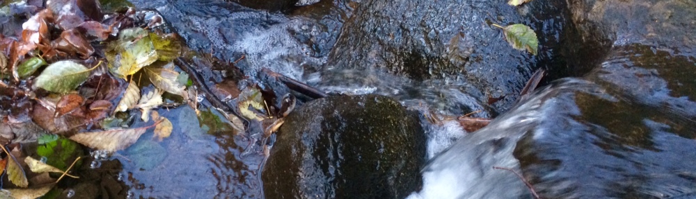
Where does our Potable Water come from?
Dr. Henderson began his talk by explaining why small islands are such interesting places to study. Since the only potable water comes from rainwater and groundwater, studying the hydrology and answering questions about the water resources and their location becomes manageable.
4 General Truths about Water
1) Water runs downhill (from high to low pressure);
2) Fresh water floats on salt water;
3) BC Government owns all groundwater;
4) The only freshwater is rainfall.
These ‘truths’ are not always true. For example, due to the Pender Island’s unique geophysical structure, Medicine Beach has a saltwater marsh, which means there is salt water floating on top of the fresh water.
Water Management Issues
There are a number of issues related to water management on Pender Island:
- Drought, saline intrusion and other contaminants such as E. coli.
- Well water interference, seismicity, and lack of alternative natural water sources.
- Lack of a coordinated water management policy between three levels of government.
Precipitation Data on Pender Island (based on 2015 information)
- Pender Island average is 803 mm per year
- One quarter of the rainfall is in Spring and Summer with three quarters being in Fall and Winter.
Summer conditions on Pender
On average, Summer is the season with the least precipitation with an increase in summer residents and visitors to the island.
What defines drought like weather?
- Drought is defined as any period which has only 60% of the average monthly precipitation.
- Historical precipitation data for Pender has shown a pattern for drought like weather. (Based on 2015 Information)
- Every 2nd year there is a summer drought
- Every 3rd year there is a Spring or Fall drought
- Every 5th year there is a winter drought.
Groundwater Recharge
- Total rainfall does not give a real picture of the availability of groundwater since approximately 64% of all rainfall is lost due to evaporation/transpiration and never becomes part of an aquifer.
- A number of other factors influence groundwater recharge including texture and gradation of the surface, topography, temperature, the volume and intensity of rain, and the nature and use of the vegetative cover.
Aquifers on Pender Island
- Many people think of an aquifer as a bowl of water sitting on bedrock under more porous horizontal layers of rock.
- Cross-sections of Pender show that rock layers here are anything but flat. A view of the rocky shoreline of Medicine Beach from the top of the bluff will emphasize this point.
- The Allison Aquifer is located above Razor Point Road along Harbour Hill.
- The geology of Pender is complicated by the presence of faults and this affects groundwater storage and the availability of water from wells. The diverse geology explains why one well will produce ample water while another well on a neighbouring property will produce less water or go dry altogether during dry conditions.
Protecting Water Availability
- Preserve aquatic and wetland habitats that help to recharge groundwater
- Trees play a significant role in recharging ground water by aiding infiltration and preventing run-off.
- Installation of rainwater catchment even if it is only for outside use can reduce the drain on groundwater.
- Information and education to residents about protecting groundwater has shown to reduce consumption by 10%.
- Installing meter readings to help detect leaks on individual properties.
- Monitoring and metering wells to determine the height of the water table.
Gulf Islands Water Capacity
- Each island has a limited carrying capacity. No research has been done to determine the carrying capacity for Pender Island.
- Carrying capacity is defined as the maximum, equilibrium number of organisms of a particular species that can be supported indefinitely in a given environment.
Pender Island Protection Zones (based on 2015 data from Dr. Henderson)
This information was presented in 2015 and is now dated due to the growth in development on both South and North Pender Island.
- 28% of North Pender is currently either protected from development or is agricultural land.
- 50% of South Pender is either protected or agricultural.
- North Pender – there are 2100 lots fully developed with a potential for 4200 additional lots to be developed.
- South Pender – there are 270 lots – the percentage of fully developed lots to undeveloped lots is not provided however, of these 270 lots there are 43 that have a potential for a subdivision.
Concerns for Existing Aquifers on Pender Island
- Excessive extraction of groundwater through wells can deplete the aquifer and can also result in saltwater intrusion, especially in areas close to shorelines.
- Salt water may not be that far below the depth of a well.
- A test well on the Roesland property on Pender Island shows that the freshwater/saltwater boundary is only 56 meters below the surface of the well.
- Once aquifers are drawn down to the point of saltwater infiltration, there is no way to reverse the process.
- Digging deeper wells or additional wells to satisfy the demand is also not a solution.
- The amount of available groundwater is always limited by the amount of rainfall.
Climate Change
- Changes in the amount of precipitation due to climate change is one factor over which we have no control.
- Managing increases in development and controlling land use will help to protect the groundwater and prevent the rate of depletion from exceeding the rate of recharge.
The information provided on this page was extracted from the 2015 presentation from Dr. Jim Henderson. His visit to Pender Island was sponsored by PITPS and PICA with financial support from the CRD.